
A history of the Fort Pierce Inlet
BY JEAN ELLEN WILSON
Can you imagine a land-locked City of Fort Pierce?
Picture Fort Pierce without marinas, without the forests of masts along the river, without our boating industry, without the people who love to fish, to cruise, to socialize at the Cove.
In 1910 the Sunrise City found itself without a path to the sea.
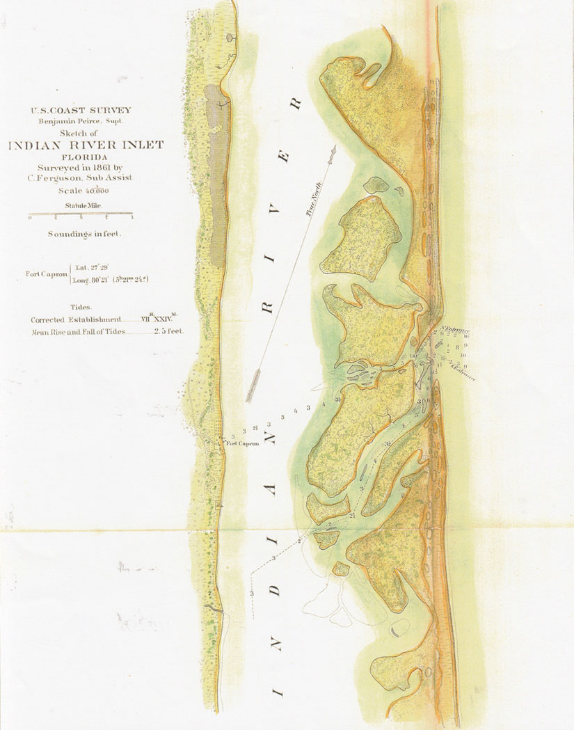
An ingress to the Ays River was shown on Spanish maps in the 1500s. For the next 300 years, it was the most dependable entry to the Indian River south of Mosquito Inlet at what is now New Smyrna. By 1845, its name was Indian River Inlet. Ships used it to bring in supplies to U. S. troops in South Florida during the Seminole Wars. Arms and ammunition, food for the soldiers and fodder for their horses were delivered through the Indian River Inlet to Fort Pierce in the Second Seminole War and Fort Capron in the Third Seminole War. Wagons then transported goods to forts like Fort Jupiter to the south and, to the West, to the Kissimmee Valley forts like Drum and Bassinger, and to posts around Lake Okeechobee.
During the Civil War, Confederate blockade runners sneaked out of their hiding places in the Indian River to carry cotton to Nassau to trade for goods needed by the South. Many were captured or destroyed by the Union gunboats who patrolled the waters around the entrance of the Indian River Inlet.
At the end of that fratricidal conflict, the settlement at old St. Lucie and the few houses that would become the town of Fort Pierce began to grow with the immigration of landowners of the Deep South ruined by the War, and Yankees attracted by the possibilities on this southern frontier.
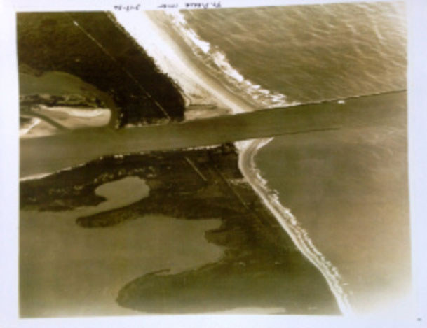
One of the first Snowbirds to invest here was Pennsylvania Senator Matthew Quay. He used his considerable influence to procure government funds to improve the old natural inlet in 1894 and again in 1903. Perhaps this well-intentioned interference with Mother caused the subsequent blocking of this historic seaway across the barrier island.
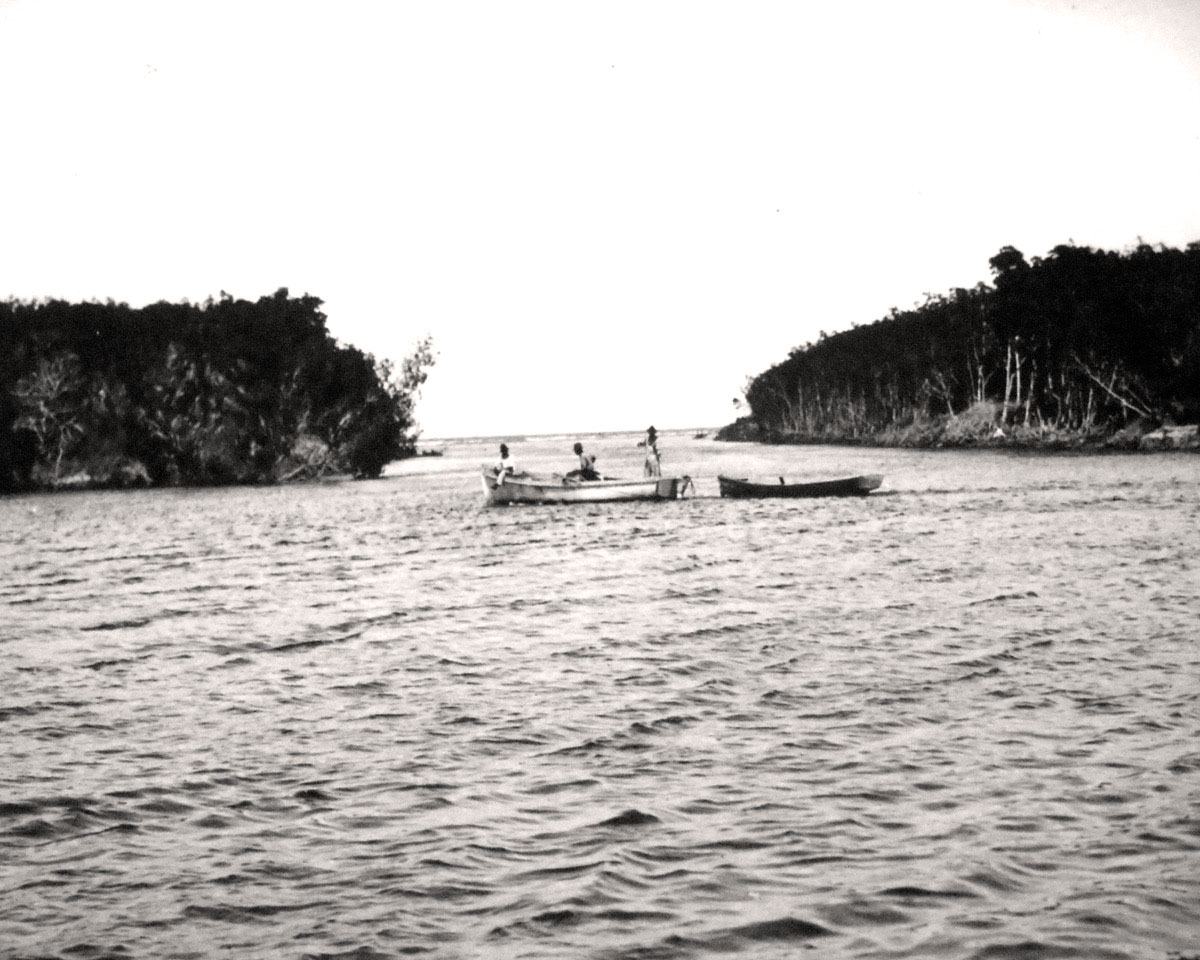
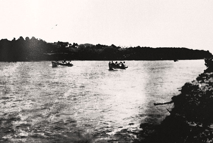
Through the first decade of the 20th century, the sand and silt continued to pile up until there came a time that fishing and recreational vessels had to be pulled across Hutchinson Island by manpower or mules on logs laid on the way.
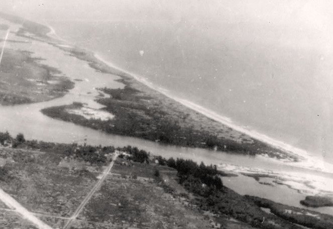
Fort Pierce leaders, recognizing the threat to the economy, founded, in 1919, the Fort Pierce Inlet District, voters approved an $80,000 bond issue, and property was purchased at Tucker’s Cove. Three additional bond issues were passed over the next few years to complete the work, finally adding up to a total of $1,850,000 voters were willing to pay to have an inlet.
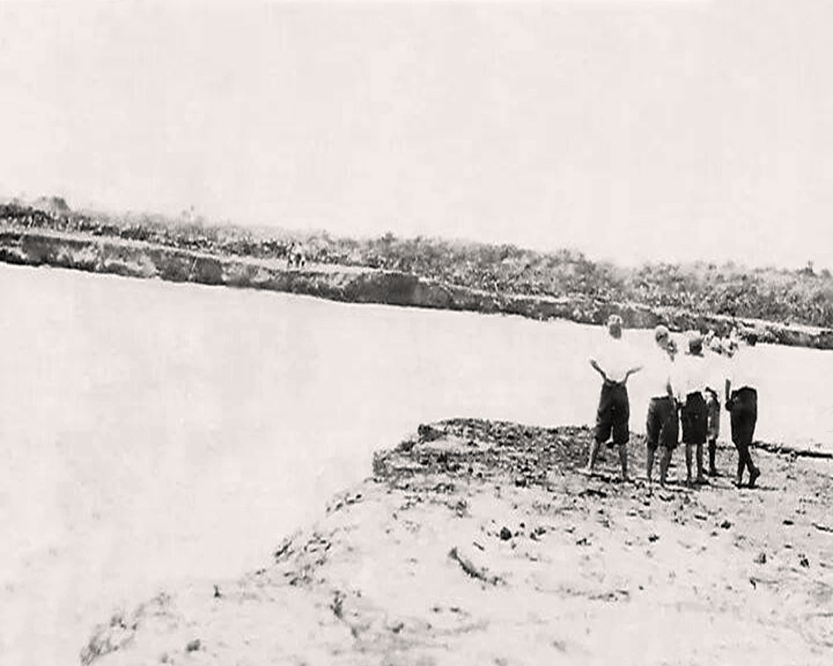
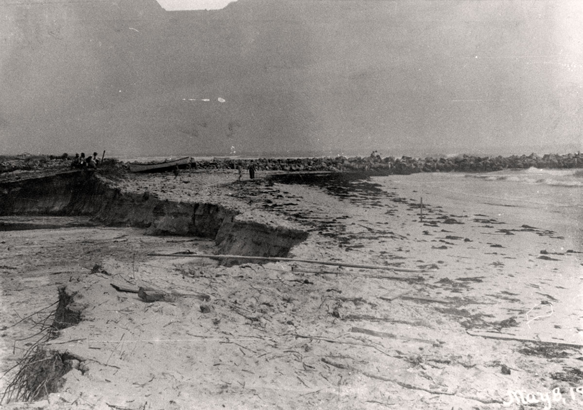
Initial dredging began in 1920, then halted while the jetties were built. The dredge Tuscawilla appeared on the river in the spring of 1921 and recommenced throwing dirt on April 19.
The News Tribune issue of May 10, 1921, reported: THE ATLANTIC AND INDIAN RIVER ARE MARRIED! The wedding ceremony took place Sunday evening about 8 o’clock when the high tide washed through the small remaining barrier of sand and swept dredge, barge, boats and all before it, cleaning out the sandy beach and practically finishing the inlet.
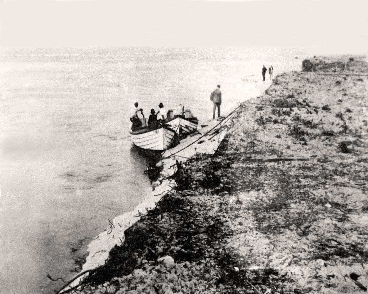
This happened on May 8, 1921. Hence, on Saturday, May 8, 2021, we will celebrate the 100th anniversary of the New Fort Pierce Inlet.
Since that spring evening of 1921, the inlet has served us well — providing access to the ocean for commercial and sports fishing, for sail and motor cruising, for divers seeking the underwater experience or Spanish treasure. We would not have the Coast Guard Station without the inlet.
For a period of time in the 30s, large cargo ships came through the Indian River Inlet; in the 40s, LSTs coursed through when the Amphibious Training base was on the island. Cargo of Indian River grapefruit headed for the East used the inlet. The inlet has fostered trade and tourism with the Bahamas; cargos of donated goods started its way to the Bahamas and Jamaica to aid victims of hurricane and earthquake through the Fort Pierce Inlet.
Boaters judge this inlet as the safest on the Treasure Coast.
Now, we have Derecktor and the exciting promise of a future with the port anchored by that company joined by the businesses and jobs it will germinate.
Plans are afoot to celebrate the Centennial. Hopefully, marking this anniversary will be a means of educating the public as to the value of our inlet and port and its importance to our economy, our pleasure, and our future.
Reprinted with permission of the St. Lucie County Historical Society.


